
The New Deal in your backyard
Find out how the New Deal shaped your neighborhood with the help of a fascinating map.

Check out this interactive map showing the impact of the New Deal of the 1930s! The map, part of the Living New Deal project, pinpoints sites throughout the United States that saw investment as part of the New Deal. This includes construction projects, forestry, artwork, parks, and so much more.
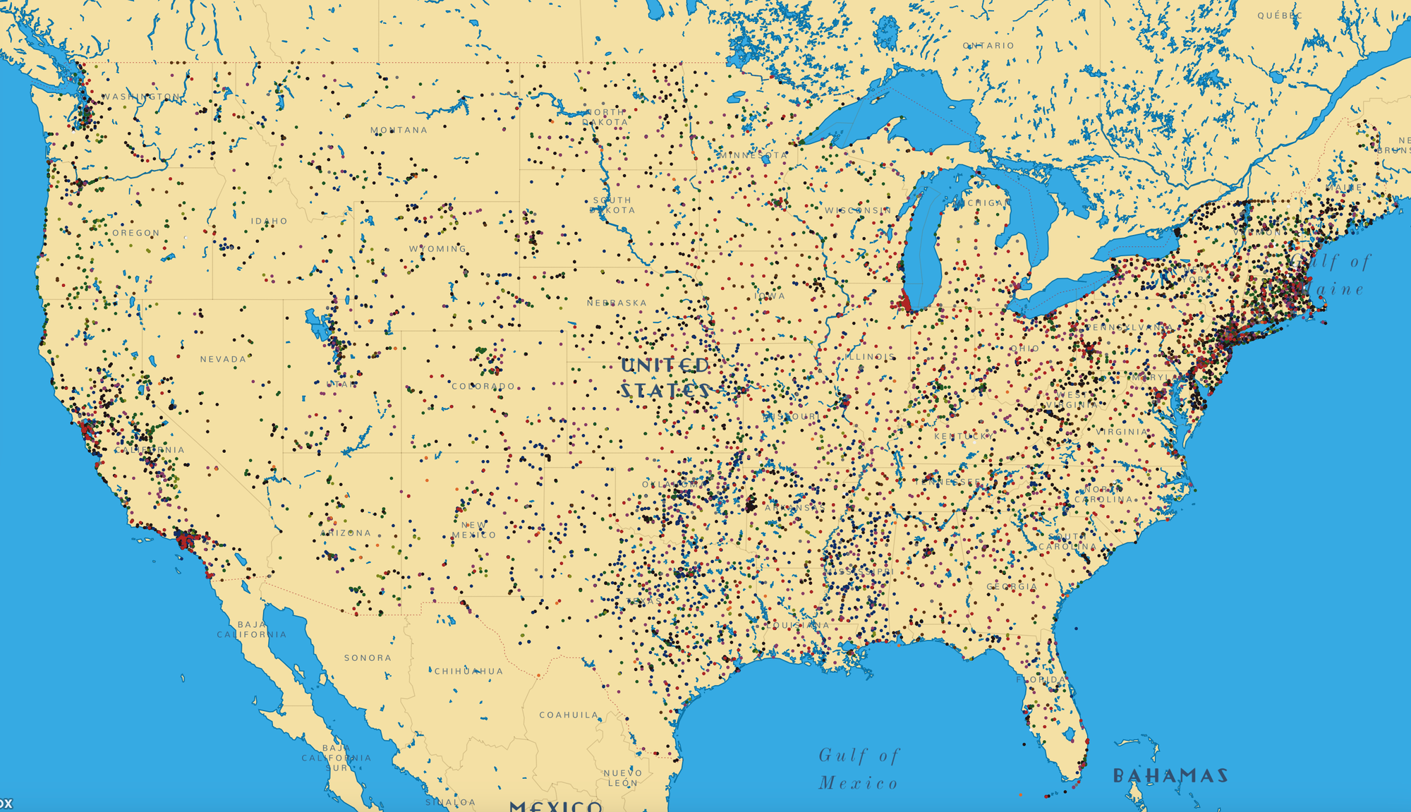
I was immediately struck by how effectively the New Deal blanketed the entire United States. Look at the dots on this map! There are very dense clusters of dots in the major cities of the day, of course, but the areas in between saw lots of investment, too. I'm not used to seeing a map of anything in the United States with such thorough coverage.
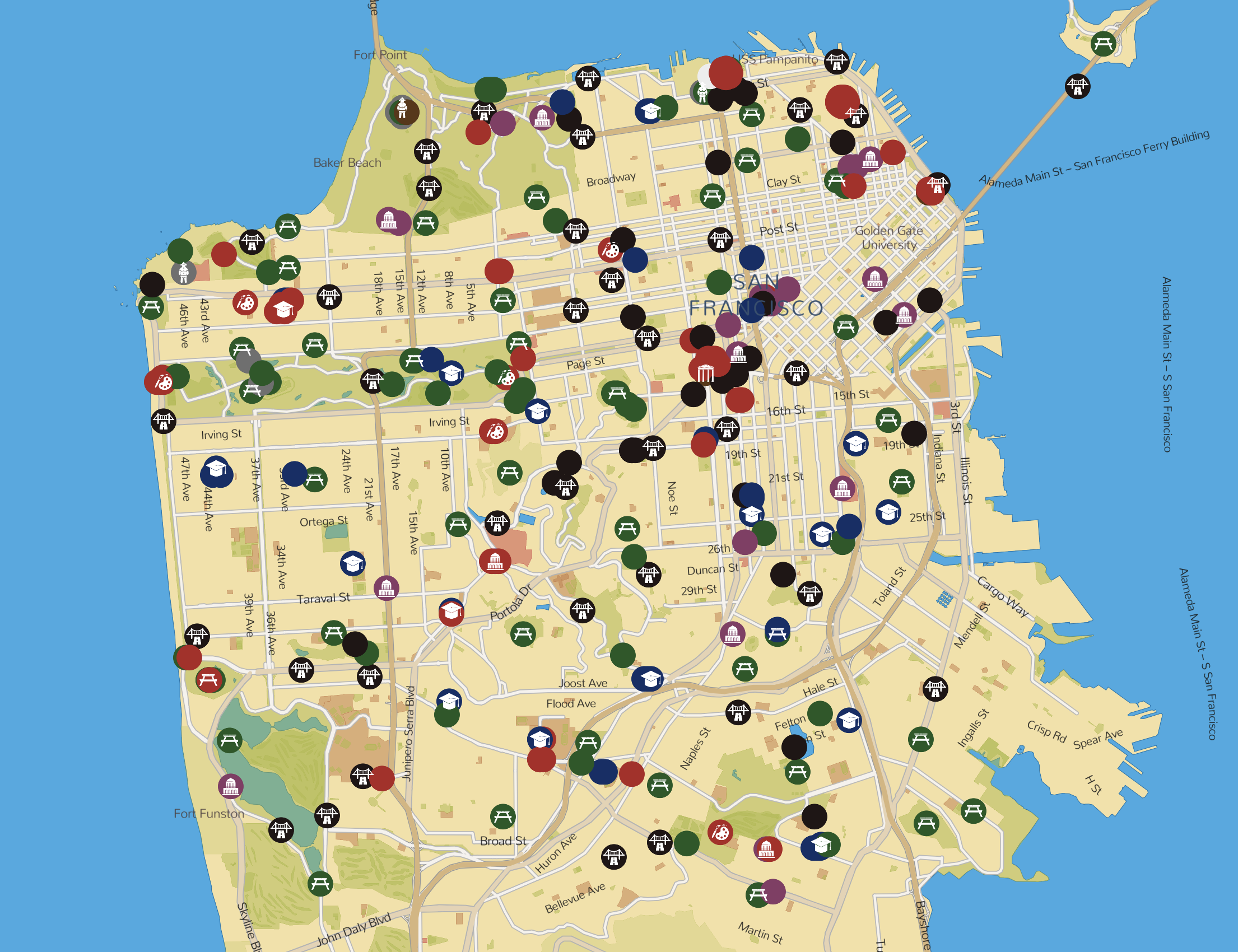
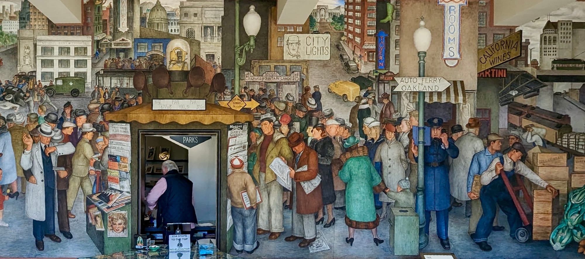
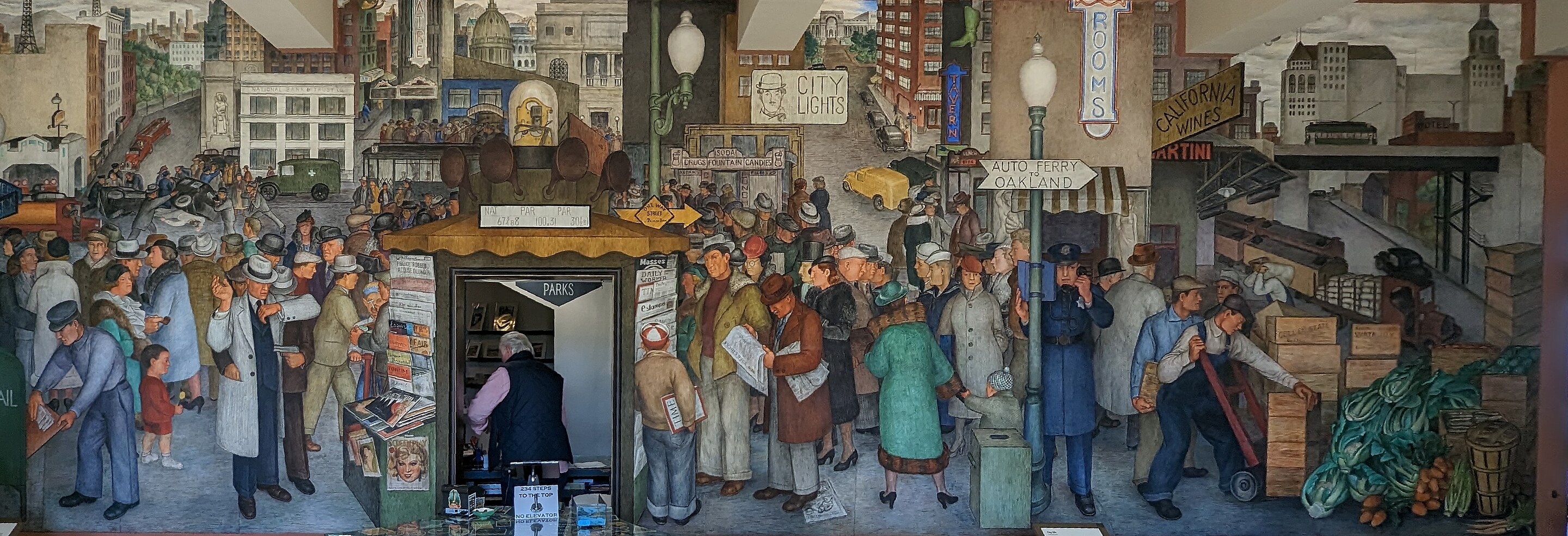
Zoom into your area to see what New Deal sites are near you. So many in San Francisco! The murals at Coit Tower were the very first New Deal art project. Just a very short walk from our house there are a half dozen New Deal sites: a school, two parks, and so much art, including tile mosaics, painted murals, and stone carvings.
The Living New Deal is a non-profit project to document the history of the New Deal (warts and all), shine a light on how its impacts are still visible today, and present a vision of how New Deal-style big thinking could help us do great things in the future.
I found this map thanks to a history lesson Wanda and I were doing a couple weeks ago about the Federal Theatre Project, which was part of the New Deal. The lesson is part of Power of the People by mint and bloom (highly recommended), and it uses Rad American History A-Z as its main text (also highly recommended).

There are no ads or sponsorships on I Have Doubt!
This post has links to products. They are not affiliate links. I don't get anything from telling you about the products.
Learn more